Recent Blog Posts


Site development and
Design Surveyors
La Crosse, WI
Same-Day Appointments
Full Project Support
Free Estimates Within 7 Days
Request Lorem Epsom
Hero Request Form
Thank you for contacting us.
We will get back to you as soon as possible.
Please try again later.
Precision Land Surveying for Your Property Needs
Paragon Associates, Inc brings unparalleled expertise to land surveying in Southwest Wisconsin and Southeast Minnesota. With over four decades of experience, our team of skilled professionals delivers accurate, reliable, and comprehensive land surveying services. We understand that each property is unique, which is why we tailor our approach to meet your specific requirements, ensuring precise measurements and detailed documentation for all your land-related projects.
As a locally owned business founded in 1994, Paragon has deep roots in the community and a thorough understanding of the region's landscape. We pride ourselves on our commitment to excellence, offering full project support from initial consultation to final delivery. Our services extend beyond traditional surveying, encompassing cutting-edge technology and methodologies to provide you with the most accurate and up-to-date information about your property.
Whether you need a boundary survey, topographic mapping, or construction staking, our team is ready to exceed your expectations. For a free estimate within 7 days or to discuss your project needs, please contact us.
Why Choose Us
Virtual Consultations
Full Project Support
Free Estimates Within 7 Days
Over 40 Years of Experience
Same-Day Appointments
Walk-In Appointments Available
Civil Engineering
Paragon's civil engineering services complement our land surveying expertise, providing a comprehensive solution for your property development needs. Our experienced engineers work closely with surveyors to design and implement infrastructure projects, ensuring seamless integration of surveying data into engineering plans. From site development to stormwater management, we deliver innovative and sustainable solutions tailored to your project's requirements.
Land Surveying
At the core of Paragon's services is our exceptional land surveying. We employ state-of-the-art equipment and techniques to provide accurate boundary surveys, topographic surveys, and ALTA/NSPS Land Title Surveys. Our team's attention to detail and extensive knowledge of local regulations ensure that your survey meets all legal and technical requirements, providing you with peace of mind and a solid foundation for your property decisions.
Landscape Architecture
Paragon's landscape architecture services blend creativity with technical expertise to transform your outdoor spaces. Our landscape architects work in tandem with our surveyors and engineers to create harmonious, functional, and aesthetically pleasing designs. From residential gardens to commercial landscapes, we consider every aspect of your property to develop sustainable and beautiful outdoor environments that enhance both value and enjoyment.

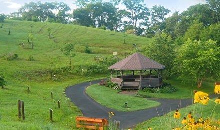
Our Recent Projects


Here's what our satisfied customers are saying...
At Paragon, we take pride in providing exceptional site development and land surveying services to our customers. We would be grateful if you could share your thoughts about our locally owned business with others. Your feedback helps us improve and helps others make informed decisions. Please take a moment to leave a review of Paragon and let others know what you think.
Frequently Asked Questions
Embarking on a site development, infrastructure, or property planning project often generates important questions. Whether you need clarity on how our team coordinates landscape architecture with boundary assessments or want to know what to expect from our professionals, we are here to provide transparent answers. This guide offers insight into our background, processes, and the comprehensive engineering services we consistently deliver for property owners throughout the local region in the Midwest. We want you to feel fully confident before you begin.
How does the initial site evaluation process work?
When you engage our surveyors in La Crosse, WI, we start by reviewing your property documentation and discussing your vision. Our team conducts meticulous background research, looking into historic records, previous plats, and adjacent property details. We then deploy our field crew to evaluate site conditions. This groundwork ensures subsequent civil engineering or landscape architecture designs are based on flawless, accurate data.
At what stage of my property development should I reach out?
It is best to involve our surveyors in La Crosse, WI at the very beginning of your project. Bringing professionals in early allows us to map out the exact boundaries, topographical features, and constraints of your land before design begins. Getting a precise picture of the landscape early helps our civil engineers and landscape architects formulate optimal plans that avoid costly revisions or regulatory delays.
What unique advantages do aerial and drone surveys provide for my land?
Modern technology has revolutionized our data capture methods. When you utilize our specialized surveyors in La Crosse, WI, you gain access to cutting-edge drone capabilities. Aerial mapping allows us to safely and efficiently gather high-resolution topographic data across large or rugged terrains. This speeds up data collection without sacrificing precision. The resulting 3D models and orthomosaic maps provide a highly detailed overview of your property’s unique characteristics.
How do your services integrate with civil engineering?
The incredible synergy between our departments is our greatest strength. When our surveyors in La Crosse, WI complete their fieldwork, the detailed site maps are passed directly to our in-house civil engineering staff. Working under one roof perfectly prevents any communication disconnect. Engineers use this exact data to design reliable stormwater systems, plan robust infrastructure, and ensure development elements align seamlessly with the site.
Can your team assist with local regulatory compliance?
Navigating local municipal codes is a crucial part of property development. By choosing our experienced surveyors in La Crosse, WI, you partner with professionals who understand regional zoning laws, setback requirements, and subdivision regulations. We provide the precise exhibits and certified documentation required by planning departments. Our team guides you through the regulatory maze, ensuring your infrastructure design meets compliance standards smoothly.
Do you map for specialized stormwater management systems?
Proper water drainage is absolutely vital for any site development, and our surveyors in La Crosse, WI play an integral role here. We conduct exhaustive topographic mapping to track the natural flow of water across your property elevations. Our civil engineers then use these contours to design highly effective stormwater systems, retention ponds, and grading plans that mitigate flooding risks and protect the surrounding environment.
What should I expect if my project requires construction staking?
Construction staking effectively bridges the gap between digital blueprints and the physical world. Once plans are finalized, our surveyors in La Crosse, WI return to your property to mark locations for foundations, roads, and utilities. We set highly visible markers to guide contractors. This support ensures every single structure is built precisely according to engineered plans, eliminating guesswork and preventing expensive building errors during construction.
How does landscape architecture fit into your services?
While accurate measurements are highly analytical, creating engaging outdoor environments requires a distinct creative touch. After our surveyors in La Crosse, WI map physical boundaries and site topography, our landscape architects optimize the space. They design beautifully functional planting schemes, elegant circulation paths, and layouts that harmonize perfectly with natural features. This collaboration ensures your final landscape is not only beautiful but structurally sound.
Will I need to be present while crews are on my property?
In most cases, you do not need to be physically on-site while our surveyors in La Crosse, WI perform fieldwork. As long as our dedicated professionals have safe, unimpeded access to necessary areas, we can conduct boundary measurements, topographic mapping, and drone flights independently. We handle the technical heavy lifting outdoors and will communicate findings to you clearly during follow-up consultations and reporting sessions.
How do you ensure accuracy when resolving historical boundary discrepancies?
Uncovering true physical limits often requires untangling decades of historical changes. When faced with complex delineations, our surveyors in La Crosse, WI rely on a combination of meticulous archival research and advanced field technology. We cross-reference old deeds with modern GPS measurements to accurately define property boundaries. This rigorous approach ensures your land rights remain fully protected for all future development plans.
Recent Blog Posts